
SUMMIT
Satellite-based Utility for Monitoring Mountain Integrated Transitions
Co-funded by ESA – Business Applications and Space Solutions (BASS) Programme
Aim: to combine measurements from various sources, such as snow/weather stations, satellite data, and GNSS stations (snow parameters and ground movements) to provide insights on hazards and risks regarding avalanche and ground movements.
GReD activities: GeoGuard hardware and software adaptation for snow analyses; GNSS data processing for snow parameters and ground movements.
GRailMon
GNSS for Rail Monitoring
Co-funded by ESA – Business Applications and Space Solutions (BASS) Programme
The GRailMon project aims to fine-tune and demonstrate an innovative GNSS-based solution for monitoring the 3D position of sections of railway tracks with millimeter precision.
HEMOC
HEritage MOnitoring in Como
Finanziato nell’ambito dei Bandi a Cascata del Programma NODES, sostenuto dal MUR sui fondi PNRR MUR – M4C2 – Investimento 1.5 Avviso “Ecosistemi dell’Innovazione”, nell’ambito del PNRR finanziato dall’Unione europea – NextGenerationEU (Grant agreement Cod. n.ECS00000036).
The HEritage MOnitoring in Como (HEMOC) project proposes developing a system for collecting and using data to preserve cultural heritage. Utilizing cutting-edge digital technologies like virtual reality, satellite data, IoT sensors, and cloud computing, HEMOC will assess the structural stability of historically and architecturally significant areas and buildings, particularly in Como’s historic center, affected by slow subsidence phenomena. The solution will monitor millimetric movements of critical points, integrating various monitoring technologies, including GNSS, InSAR, drones, and traditional topographic surveys. Additionally, specialized interfaces, including virtual reality, will streamline access to the collected information, simplifying the interpretation and management of the monitored cultural assets.
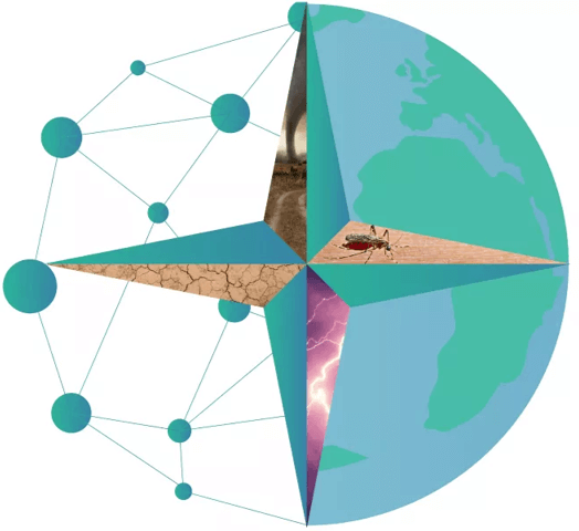
EASTERN
EArth obServation models for weaThER eveNt mitigation
Finanziato nell’ambito dei Bandi a Cascata del Programma NODES, sostenuto dal MUR sui fondi PNRR MUR – M4C2 – Investimento 1.5 Avviso “Ecosistemi dell’Innovazione”, nell’ambito del PNRR finanziato dall’Unione europea – NextGenerationEU (Grant agreement Cod. n.ECS00000036).
The project focuses on monitoring flood events and proposes two specific areas of work.
Direct Risk Identification (Landslides):
- Mark landslide-prone areas for strategic installation of ground sensors (GNSS) to monitor infrastructure;
- Enhance the temporal granularity of satellite information for more precise assessments.
Indirect Risk Identification (Spread of Infectious Diseases):
- Estimate the increase in the spread of insect-borne infectious diseases following flood events.

Q-SING
Quantum-based Simultaneous Inertial Navigator and vector Gravimeter
Funded by Horizon Europe – European Defence Fund (EDF)
The project Q-SiNG will provide a navigation system demonstrator for GNSS-denied areas.

FIQUGS
FIeld QUantum Gravity Sensors
Funded by Horizon Europe
The objective of the FIQUgS project is to develop the latest generation of quantum gravity sensors. These devices are used to determine the absolute value of gravitational acceleration by utilizing the phenomenon of cold atom interferometry. These highly advanced instruments are expected to be further improved in the coming years, through the combination of several technologies, including quantum gravimetry and ground penetrating radar

SMILE
MultidiSciplinary and MultIscale approach for coupLed processes induced by geo-Energies
Funded by Horizon Europe – Marie Skłodowska-Curie Actions (MSCA)
Ambition: SMILE aims at training a new generation of scientists that become experts in coupled processes occurring in the subsurface as a result of fluid injection/extraction to respond to the increasing demand on geo-energy applications.
GReD activities: 1 Executive PhD student, enrolled at Politecnico di Milano, will be employed by GReD. Project title: “Automated analysis of ground deformation time series”. Objectives: “To develop an automated software tool to analyze the ground deformation time series obtained from Galileo-enabled
low-cost GNSS receivers, also in conjunction with area-wise DInSAR monitoring and with a-priori information from ground modeling.
TEMBO
Transformative Environmental Monitoring to Boost Observations in Africa
Funded by Horizon Europe
Ambition: to close the environmental in situ data gap in Africa. To fulfill this ambition, TEMBO’s general objective is to have cost-effective innovative sensor networks that can be financed by the climate services we develop using these sensors.
GReD activities: conceptualization, design and development of the GNSS-based tools and services for dam deformation monitoring, atmospheric water vapor monitoring, and soil moisture monitoring through GNSS reflectometry.

MAGDA
Meteorological Assimilation from Galileo and Drones for Agriculture
Funded by Horizon Europe / EUSPA
Aim: develop a toolchain for atmosphere monitoring, weather forecasting, and severe weather/irrigation/crop monitoring advisory, with GNSS (including Galileo) at its core, to provide useful information to agricultural operators.
GReD activities: project coordination and management. Conceptualization, design and development of the GNSS-based tools for atmospheric water vapor monitoring and soil moisture monitoring through GNSS reflectometry.

XORN
eXperimental jOint inveRsioN project
Funded by ESA
Aim: to study, design and develop a joint 3D inversion of gravity and magnetic fields by means of a probabilistic Bayesian approach and apply it to study the Mediterranean Sea area.
GReD activities: project coordination and management. Conceptualization, design and development of the 3D inversion algorithm and its application for the Mediterranean Sea case study.
HYPER-5G
HYbrid Positioning Engine Running on 5G and GNSS
Funded by ESA
Aim: to study, design and develop the algorithms and software needed to implement a precise positioning engine to jointly use multi-constellation GNSS and 5G observations.
GReD activities: project coordination and management. Conceptualization, design and development of the GNSS positioning engine (leveraging the PPP-RTK technique) and of the hybrid positioning engine.
RTAID
Rail Track Assignment Inconsistency Detector
Funded by ÖBB
Aim: to study, design and develop software for the automatic detection of changes in a railway track network, based on position data generated by GNSS receivers onboard the trains.
GReD activities: project management. Conceptualization, design and development of the detection algorithm; development of the operational software to be run at the railway operator’s premises; extensive testing and validation based on real input data.
CAMALIOT
Application of Machine Learning Technology for GNSS IoT Data Fusion
Funded by ESA
Aim: to study and demonstrate the feasibility of exploiting crowdsourced GNSS Big Data to derive information of interest across different fields of application
GReD activities: Pre-processing and processing of smartphone-derived GNSS raw observations to estimate tropospheric and ionospheric delays. Validation of the use cases selected in the project.
SINOPTICA
Satellite-borne and IN-situ Observations to Predict The Initiation of Convection for ATM
Funded by H2020
Aim: to improve the mathematical models used in the prediction of extreme weather events, in order to support air traffic management
GReD activities: Processing of nation-scale GNSS raw observations to derive tropospheric delays to be assimilated into numerical weather prediction models; deployment of a cost-effective GNSS station near Malpensa airport to monitor the local variations of atmospheric water vapor

GIADA
Gravity for lIthosphere Architecture Determination and Analysis
Funded by European Space Agency, Business Applications Space Solutions
Aim: GIADA is GIULIA follow-on. The project exploits gravity field observations, mainly derived from GOCE mission, with others in situ data to build maps of main geological provinces and 3D model of the Earth crust at regional scale. The service results help oil & gas and mining companies in the preliminary exploration activities to identify regions with high potential in terms of natural resources exploitation.
GReD activities: Principal investigator

GIULIA
Gravity Inversion to Understand LItospheric Architecture
Funded by European Space Agency Value Adding Element
Aim: Development of an innovative service in which GOCE gravity data, in terms of global gravity field model, are exploited to estimate the main features of the Earth crust at a regional scale for the oil&gas “Assets and Prospects” operations
GReD activities: Principal investigator

LAMPO
Lombardy-based Advanced Meteorological Predictions and Observations
Funded by Fondazione Cariplo
Aim: Development of an innovative nowcasting method for heavy rain, based on water vapor measurements performed by low-cost GNSS stations
GReD activities: Deployment of LAMPO stations north of Milan, near-realtime data processing to derive water vapor information to be delivered to ARPA Lombardia for evaluation
TWIGA
Transforming Weather Water data into value-added Information services for sustainable Growth in Africa
Funded by H2020
Aim: Enabling satellite-based and ground-based geo-services in Africa
GReD activities: Deployment of low-cost GNSS stations in sub-Saharan Africa and data processing to provide water vapor data to meteorologists, for improved forecasts of extreme weather events

GIMS
Geodetic Integrated Monitoring System
Funded by H2020
Aim: Build and commercialize an advanced low-cost system based on EGNSS, Copernicus SAR and other in-situ sensors, like inertial measurement units, to monitor ground deformations
GReD activities: Development of new GNSS processing software to process data coming from Galileo-enabled, dual-frequency low-cost receivers. Integration of GNSS, InSAR and accelerometers to provide a complete solution for landslide monitoring

BRIGAID
BRIdging the GAp for Innovations in Disaster resilience
Funded by H2020
Aim: Provide integral support for innovations for climate adaptation, focusing on climate-driven disasters like floods, droughts and extreme weather
GReD activities: Deployment of four low-cost GNSS stations in Rotterdam (The Netherlands) and four more in Monterosso al Mare (Italy); data processing to retrieve water vapor information; study of the relation between water vapor and rain events
STEAM
SaTellite Earth observation for Atmospheric Modelling
Funded by European Space Agency
Aim: Ingestion of high-resolution remote sensing data products (GNSS, SAR) in high-resolution numerical weather models to improve intense rain forecasts
GReD activities: Processing of data collected all GNSS stations available in Italy to derive water vapor data to be assimilated into numerical weather prediction models to improve the forecast of two rain events
EDWIGE
Early Detection of Water-vapor Instabilities by GNSS Estimation
Funded by EUROSTARS-EUREKA
Aim: Development of prototypal low-cost dual-frequency GNSS stations, for atmospheric water vapor monitoring
GReD activities: Deployment of a dense network of prototype stations and data processing to evaluate their performance